Tewet Tarn occupies a commanding position on the northern slopes of the diminutive Low Rigg. At a height of 680ft/207m and on its own little plateau the ground slopes away on the other 3 sides giving unrestricted views across St Johns in the Vale to the east and across both the Northern and North Western Fells.

A footpath runs along its eastern side giving two points of access from the north or the south. I chose the one from the north on the minor road linking Keswick with St Johns in the Vale. It is shorter and more direct and there is room to park a car just off the road a few hundred metres north of the path. I did my homework for Tewet Tarn the previous day after finishing at Castlerigg Stone Circle just over a mile to its west. The nearest town is Keswick a few miles to the west and the village of Threlkeld is a few miles to the north east.
The weather forecast the previous evening for sunrise was one of doom and gloom – persistent low cloud, mist and a 70% chance of drizzle to last most of Sunday – how wrong they were. I'm glad I made the effort to go up, staying in Keswick a few miles west helped. Thanks also to a contact on Flickr, Brian Kerr, whose photos from Tewet Tarn gave me the inspiration.

It turned out to be a stunning sunrise. With about 15 minutes to go the sky had a pink tinge to it and this became orange/red just before the sun rose. This contrasted well with the cooler blues of the banks of mist and heavy cloud moving north along St Johns in the
Vale.
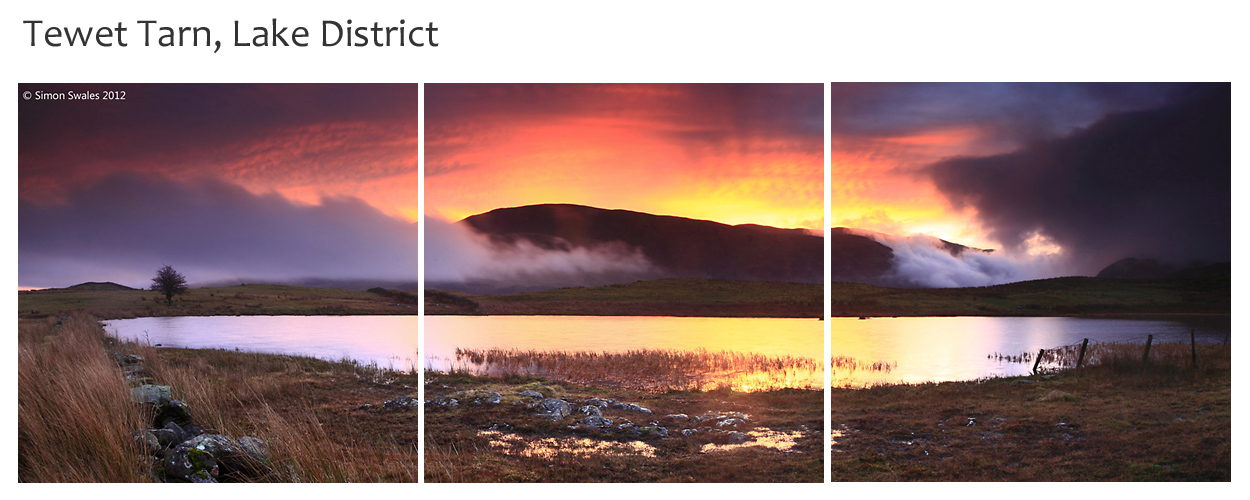
The
weather did deteriorate rapidly during the morning until well into the
afternoon with low cloud, mist and drizzle/rain affecting much of north western Lakeland. I can live with that :-)
____________
Map of the local area around Tewet Tarn is shown below. Keswick is the nearest town and needs no introduction for the facilities it offers. The Horse & Farrier Inn at Threlkeld serves great food and Jennings ales.
No comments:
Post a Comment