Pages

Thursday, 21 March 2013

Go Fife: Seafield, Kirkcaldy


Seafield beach, Kirkcaldy on a Thursday afternoon in late March.  I arrived with about an hour to go before low tide (due at 4pm) to see the waves rolling in and a bit of colour in the heavy sky so stayed for about 2 hours.  Was absolutely baltic but you tend to forget the cold when you absorb yourself in rocks and waves and cleaning filters and watching for rogue waves (above).  

An Inukshuk is a stone landmark or cairn built by the Inuit and other peoples of the Arctic regions of North America. The Inukshuk may have been used for navigation, as a point of reference, a marker for travel routes, fishing places, camps or hunting grounds as well as other uses.  Today I decided to build my own version of an Inukshuk using big boulders next to the sea.  As the tide was due to come back in it would be temporary only but would serve as a prop.  The stormy weather migrated westward and was replaced by a brief interval of blue sky before more overcast conditions signalled an end to the best light at which time I called it a day.

Seafield beach is on the south side of Kirkcaldy.  Accessed from Seafield Road, off Kinghorn Road (A921).  The gate to the car park is automatically controlled to open at 6:30am and close at 10:30pm.  There is a height restriction for cars only.  

Sunday, 10 March 2013

Photo of the Month: February 2013

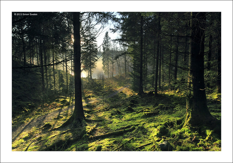
Shadowlands, Loch Ard Forest, Trossachs - Shortlisted: OPOTY 2014
Loch Ard Forest, Trossachs


18th February 2013, Loch Ard Forest.

A perfect winter's day Loch Ard Forest, Loch Lomond and The Trossachs National ParkLoch Ard was a sheet of ice with the low sun creating pockets of mist in its more sheltered bays. Some sections of the shore were completely frosted over. I walked a circuit from Milton along the forest roads on the south side of Loch Ard to coincide with sunset. On reaching a footpath which loops around a particularly rugged section of the shore, I noticed this scene which was quite magical.  Fearing the sun might at any moment drop below the hills behind I climbed to a vantage point above the path, set up my tripod and camera and worked quickly to record the scene.  It turned out to be one of the finest afternoons photography I have had.  

Technical Info:

Taken with a Canon EOS 5D mkII
Zeiss Distagon T* 21/2.8 ZE lens
EXIF: ISO-100 / 0.3 sec / f/16
RAW File converted to TIFF in Canon DPP, developed in Adobe PSE9

Shortlisted image - 'Light on the Land' category - Outdoor Photographer of the Year 2014

Featured in Outdoor Photography Magazine - Locations Guide / Viewpoints - Issue 188 / Feb 2015


Website  /  Profile

Friday, 1 March 2013

MOO Business cards

I asked Google a question on Tuesday "can you use the Flickr logo on business cards".  A list of answers came up on the screen.  One was for a company that would give you 50 FREE business cards with your Flickr Photos on the reverse so I clicked through to the moo.com site.

MOO / Flickr advert for Business cards
Sure enough, they would give you 50 business cards with your personal details on one side and a photo from your Flickr site on the reverse.  You could upload as many photos as you wanted (up to 50) and they would print them on the reverse.  They call this 'printfinity'.  Seemed to good to be true.  All they wanted was £3.50 for P&P.

Registered with them and then went through their menu system to upload photographs directly from Flickr. Decided to use 10 photo's and it took about an hour to complete the process.  MOO would print a small version of their logo on the picture side of the card to advertise their brand.  Seemed fair enough as they were FREE.  

Today they arrived.  Wow!  350gsm card with a rich matte finish!

Have now got a small portable portfolio I can carry with me.

9 of the photos I selected (click to view at full size)


Wednesday, 20 February 2013

Getty Images

Simon Swales on Getty Images (click for LARGER size)

Received an email yesterday from Flickr HQ with an invitation to license some of my photos for commercial use with Getty Images. 

The Getty Images team noticed my work on Flickr and offered me an invitation to enroll with them which I accepted.  Lots of form filling but I am now on the Getty program.

They initially selected 7 photos for possible inclusion in the program.  Once I uploaded them and filled in the details and credits they were sent to one of their moderators for approval.  Checked a few days later and found that they were approved and are now on their website.  By the end of February the had asked for another 21 images which have all been approved and are now for sale / licensing on the Getty Images website.

Click through to view on Getty Images


Sunday, 10 February 2013

Photo of the Month: January 2013

Tequila Tewet
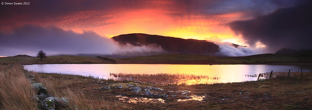
Pre-sunrise light over Tewet Tarn, Lake District


To get this new series off the ground the photograph I have chosen is one from our visit to Keswick in early January 2013.

Tewet Tarn occupies a commanding position on the northern slopes of the diminutive Low Rigg.  At a height of 680ft/207m and on its own little plateau the ground slopes away on the other 3 sides giving unrestricted views across St Johns in the Vale to the east and across both the Northern and North Western Fells.

The weather forecast the previous evening for sunrise was one of doom and gloom – persistent low cloud, mist and a 70% chance of drizzle to last most of Sunday – how wrong they were. It turned out to be a stunning sunrise.  With about 15 minutes to sunrise the sky had a pink tinge to it that became orange/red just before the sun rose.  This contrasted well with the cooler blues of the banks of mist and heavy cloud moving north along St Johns in the Vale.

Technical Info:

Two frame stitch taken with a Canon EOS 5D mkII
Canon EF 24-105mm f/4L IS USM lens @ 24mm
Lee filters: 0.9 & 0.6 GND (H)
EXIF: ISO-100 / 1.5 sec / f/11 x 2 frames
RAW File converted to TIFF in Canon DPP, stitched and developed in Adobe PSE9

Website / Profile

Sunday, 6 January 2013

On Vacation: Tewet Tarn, The Lake District

Tewet Tarn occupies a commanding position on the northern slopes of the diminutive Low Rigg.  At a height of 680ft/207m and on its own little plateau the ground slopes away on the other 3 sides giving unrestricted views across St Johns in the Vale to the east and across both the Northern and North Western Fells.  

A footpath runs along its eastern side giving two points of access from the north or the south.  I chose the one from the north on the minor road linking Keswick with St Johns in the Vale.  It is shorter and more direct and there is room to park a car just off the road a few hundred metres north of the path. I did my homework for Tewet Tarn the previous day after finishing at Castlerigg Stone Circle just over a mile to its west. The nearest town is Keswick a few miles to the west and the village of Threlkeld is a few miles to the north east. 

The weather forecast the previous evening for sunrise was one of doom and gloom – persistent low cloud, mist and a 70% chance of drizzle to last most of Sunday – how wrong they were.  I'm glad I made the effort to go up, staying in Keswick a few miles west helped.   Thanks also to a contact on Flickr, Brian Kerr, whose photos from Tewet Tarn gave me the inspiration.

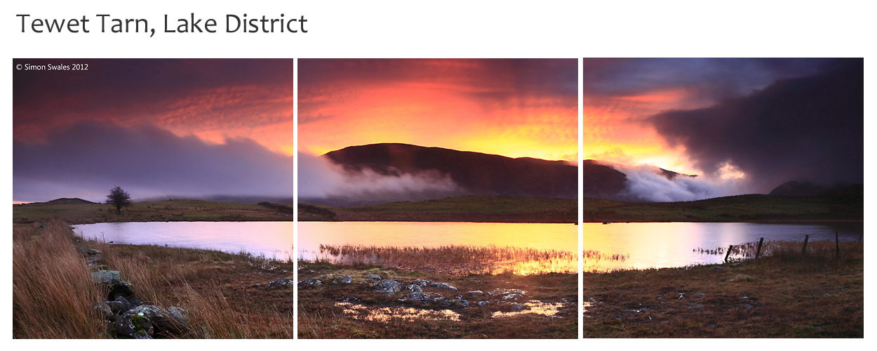
It turned out to be a stunning sunrise.  With about 15 minutes to go the sky had a pink tinge to it and this became orange/red just before the sun rose.  This contrasted well with the cooler blues of the banks of mist and heavy cloud moving north along St Johns in the Vale.

The weather did deteriorate rapidly during the morning until well into the afternoon with low cloud, mist and drizzle/rain affecting much of north western Lakeland.  I can live with that :-) 

____________

Map of the local area around Tewet Tarn is shown below.  Keswick is the nearest town and needs no introduction for the facilities it offers.  The Horse & Farrier Inn at Threlkeld serves great food and Jennings ales.  


Saturday, 5 January 2013

On vacation: Castlerigg Stone Circle

Castlerigg Stone Circle is one of the most famous stone circles and one of the most visually impressive prehistoric monuments in Britain.  It is situated on a small plateau a few miles east of Keswick in the heart of the Lake District National Park.  The plateau forms the raised centre of a natural amphitheatre created by the surrounding fells and from within the circle it is possible to see some of the highest mountains in England including Helvellyn (3117ft), Skiddaw (3054ft), Blencathra (2848ft) and Grasmoor (2795ft).

The site is well signposted from Keswick on the minor road which leads to St John's in the Vale.  Free parking for cars is provided in large lay-bys on the road adjacent to the site.  It is very popular with tourists especially on weekends and during holiday periods.  The best time of day to photograph the monument is at sunrise or sunset when the lighting is dramatic although the fells provide a magnificent backdrop at all times but especially in the autumn.  
It was forecast for strong winds, dark clouds and perhaps some rain at sunrise on 5th January but as I was staying in Keswick I made my way out to the Stone Circle hoping for the best.  I arrived before dawn and found the circle by colliding with one of the stones which wasn't the best start.  The sky started to lighten from the east and there was indeed heavy black cloud at low levels accompanied by strong winds.  The only chunk of colour in the sky happened before sunrise above Clough Head.  Once the sun had risen the light was dramatic for about an hour as the sky was full of heavy cloud giving lots of deep shadows on the fells.  Luckily it didn't rain.  I had the circle to myself for about 2 hours which allowed me time to wander around without disturbing others.  It was only as I reached my car that the days first tourists were arriving but by this time the best of the light had gone. 


Map of the local area around Castlerigg Stone Circle is shown below.  Keswick is the nearest town and needs no introduction for the facilities it offers.  The Horse & Farrier Inn at Threlkeld serves great food and Jennings ales.